What was the political plan of the French king Louis XIV for the Cycladic Archipelago in 1685? Why did he send there, under great secrecy, experienced mariners and engineers for the mapping of strategic sea locations? It could be that modesty was not one of “Sun King’s” virtues, who was declaring “L'etat, c'est moi” (I am the state). But he knew about politics, diplomacy and strategic operations ensuring the French interests in geographic locations of crucial importance, amongst them the Eastern Mediterranean, where the Aegean is located. Proof is the exhibition “Archipelago 1685-1687 in the maps of Louis XIV” which is hosted in Telloglion Fine Arts Foundation, a part of Aristotle University of Thessaloniki (AUTH), until the 2nd of April.
Safe debarkation and supply zones, fortification, defense zones, troop gathering areas and settlements are included in Louis XIV’s maps of the Cycladic Archipelagos, a fact that raises questions about what he was planning to do there.
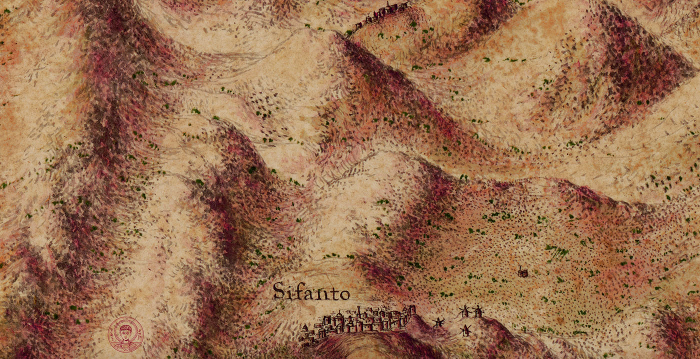
Map of Sifnos (detail). The illustration of the terrain, the shading and the color rendering is a characteristic example of high esthetic quality of maps contained in Raseau collection. Tricoglios Library LIC, AUTH.
The exhibits are two rare collections of manuscript maps that were designed by Louis XIV’s engineers and are presented to the public for the first time. They are maps that are considered to be unique worldwide as works of art but also as exceptional samples of island cartography of the 17th century, with the great scale of illustration being the extra defining characteristic, something unprecedented for this period and the geographical area of the Aegean. Specifically the scale is 1 to 5.000, “a daunting scale even by today’s standards”, as was mentioned by AUTH emeritus Cartography Professor, mr. Evangelos Livieratos, in one of his interviews.
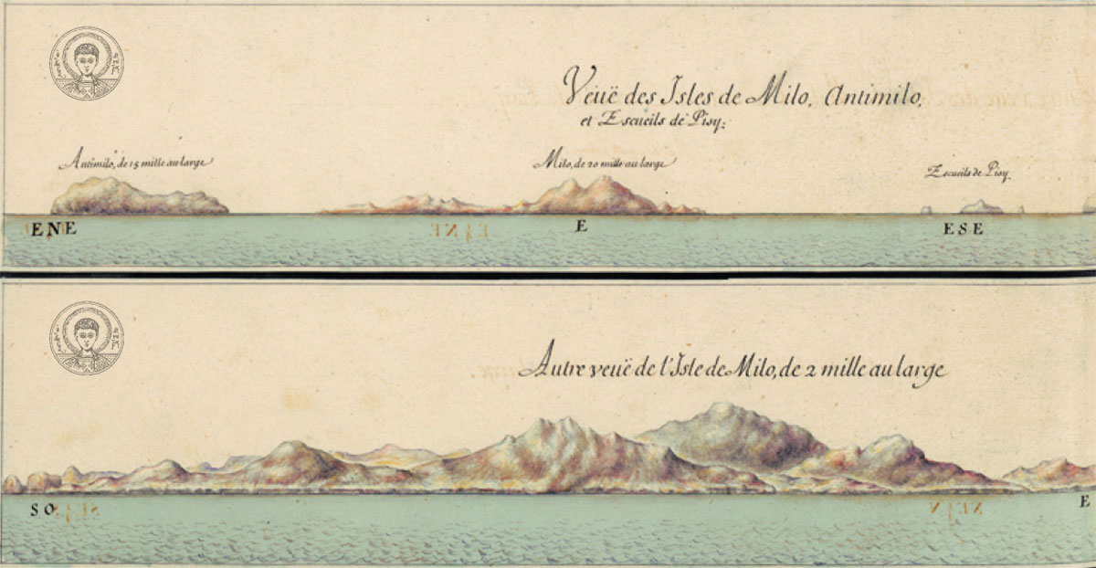
Views of the coasts of Milos from the sea. Raseau Collection, Tricoglios Library LIC, AUTH.
One of the collections is located in Greece and contains maps by engineer Raseau, while its’ twin is in France and contains maps that were designed by engineer Pétré. The first belongs to the Tricoglou Library, a prized possession of the Library & Information Centre of AUTH, the organizer of this exhibition in collaboration with the Consulate General of France in Thessaloniki and the AUTH CartoGeoLab. The second collection traveled from Service Historique de la Défense, which is located in Vincennes, in the outskirts of Paris.
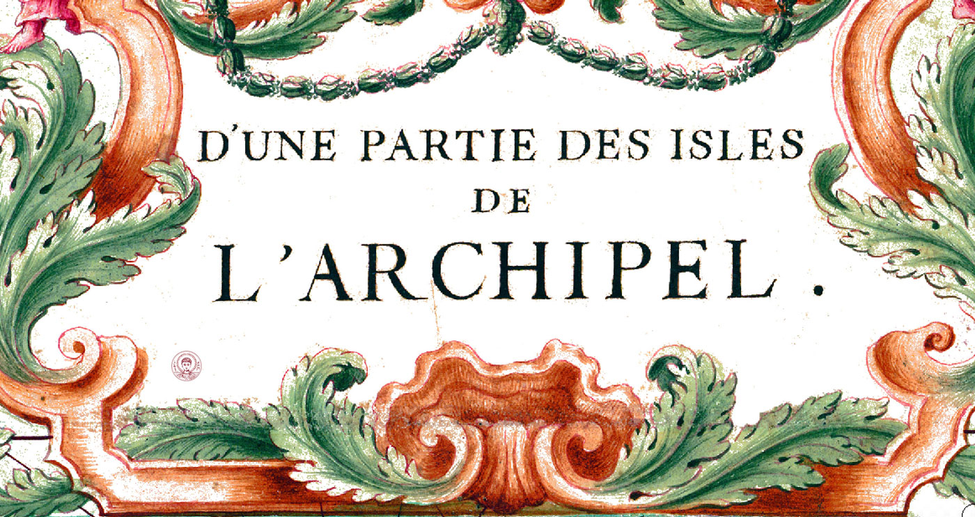
Detail of the general title in the original Catouche of Raseau map collection. Tricoglios Library LIC, AUTH.
Great secrecy and… scenarios
But let’s examine why the French Navy’s secret mission in the Aegean, in charge of which was the high ranked officer Gravier d’Ortieres, had orders to design detailed maps that would include: safe debarkation and supply zones, fortification, defense zones, troop gathering areas, settlements etc. To understand it we would have to refer to the “Holy League of Linz”, founded in 1684 from European forces, in order to contend with the territorial aspirations of the Ottoman Empire in Central Europe. The League’s successful war operations forced the Ottoman Empire to retreat to the south and to reclaim vast areas that had been annexed by Ottoman rule. The political map of southeast Europe was being altered dramatically by the war operations. What was “Sun King”, the strongest ruler of Europe, planning to do?
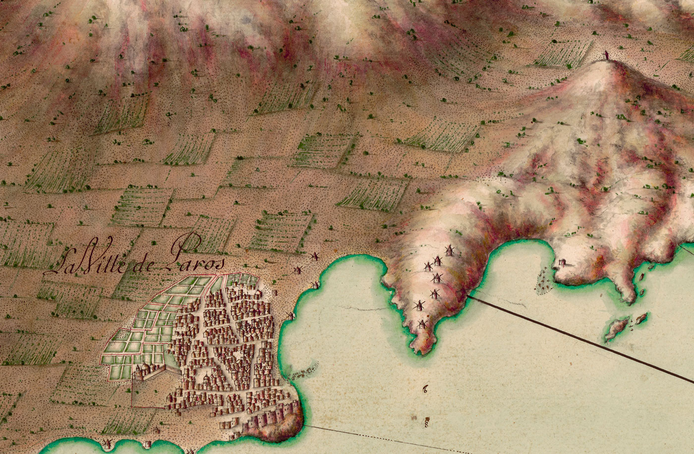
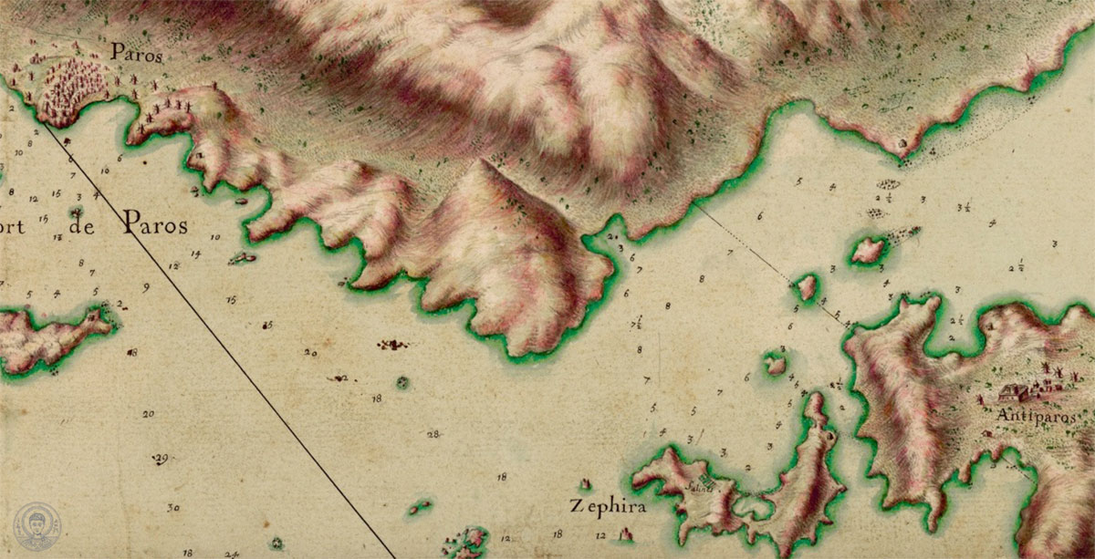
View of Paros in one of the most astonishing maps of the Raseau Collection. Tricoglios Library LIC, AUTH.
According to the researchers, a possible scenario is that Louis XIV was expecting that the long-lasting war of the Ottoman Empire with the Holy League of Linz would possibly create an opportunity that would allow him to establish his rule in Eastern Mediterranean. A second scenario is that he was likely planning to attack on his own against the Ottomans, a suggestion that was submitted by Gravier d’Ortieres, ascertaining the weaknesses of the Ottoman war machine. Whatever was Louis XIV’s plan, it was a prerequisite to have detailed maps, a fact that explains the cartographic activity of 1685-1687.
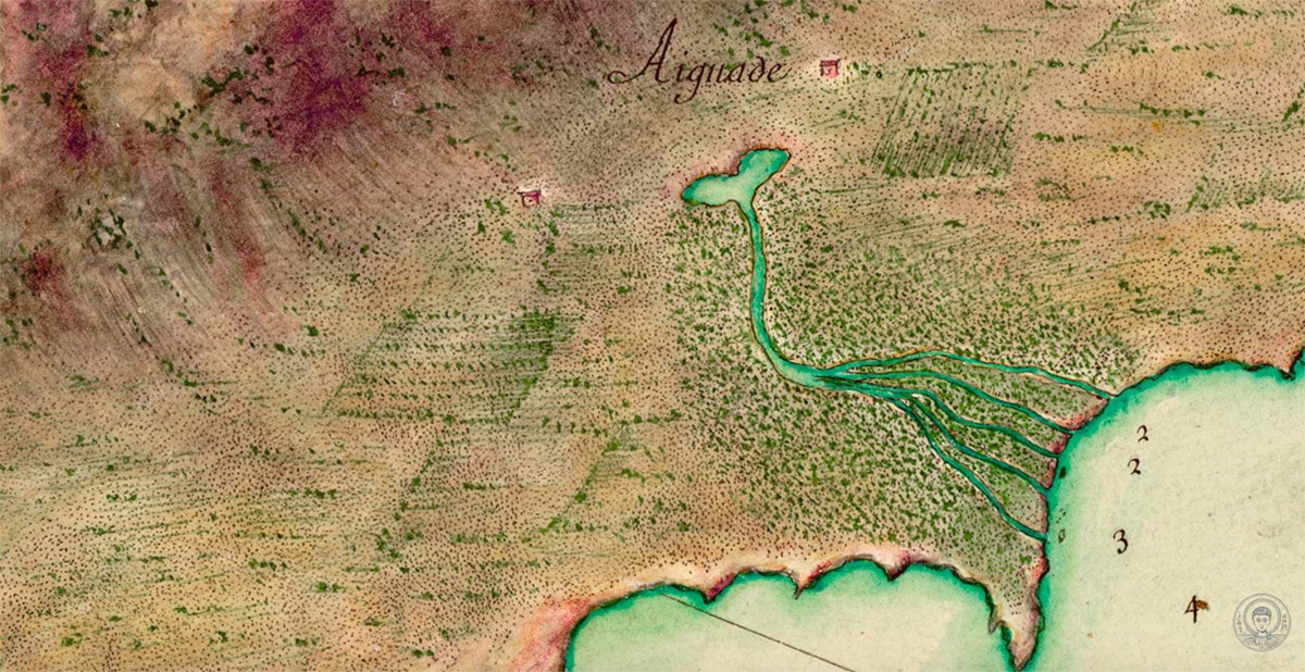
Illustration of water supply and resservoirs near the coast. Raseau Collection, Tricoglios Library LIC, AUTH.
An important role in this mapping was played by Jean Baptiste Colbert, one of the most active Finance ministers of European history. Colbert was also in change of the marine affairs of the country, a fact that explains the establishment of the French Académie des Sciences (French Academy of Sciences) by him in 1666, with systematic mapping being the first goal. Colbert focused on mapping the Mediterranean for two reasons. First, to balance the antagonistic marine presence of the British and the Dutch in the Mediterranean. Second, to protect the trading privileges that France had secured from the Sublime Porte to the Eastern Mediterranean.
Unique and… innovative
The two map collections presented in Telloglion Foundation, exceptionally important both historically and cartographically, include: 28 great size visualizations of Cyclades and 9 visualizations, of great size also, with 28 coastal views. The islands depicted are Naxos, Paros, Sifnos, Milos, Ios, Antiparos, Kimolos, Polyaigos, Folegandros, Sikinos, Iraklia, Schinoussa, Keros, Koufonisia, together with Kythera and Elafonissos. As for the coasts, the maps depict the coastlines of Peloponnese, Zakynthos, and of the Cyclades, as well as the gulfs of Tunis and Sardinia, from where French ships would cross to enter the Aegean.
The maps of the Cycladic Archipelagos designed by “Sun King’s” engineers stand out for the great scale of 1 to 5000, something unprecedented for the cartography of the 17th century, and give away the sense that modern drones were used in their creation.
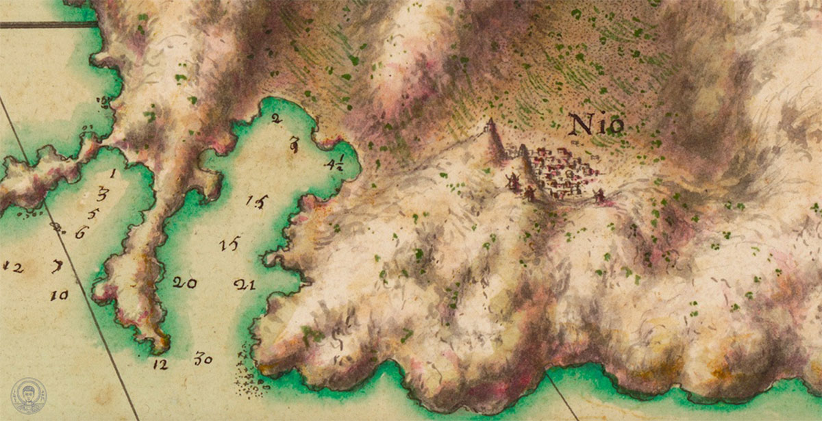
Illustration of Ios and the surrounding terrain, in connection with the coastline and the depths of anchorage locations. Raseau Collection, Tricoglios Library LIC, AUTH.
Whichever Louis XIV ‘s plan was, the importance lies to the fact that great maps were created providing information equally important for the natural but also the anthropogenic areas of the Cycladic Archipelagos during the 17th century. Also well noted is an innovation pointed out by the Greek researchers of Roseau’s maps. It is the illustration of perspective in a way that makes French cartography appear to be a precursor of drones.
Information: Exhibition “Archipelago 1685-1687 in the maps of Louis XIV”, Telloglion Fine Arts Foundation AUTH, str. Agiou Dimitriou 159A, Thessaloniki, Duration until April 2nd.
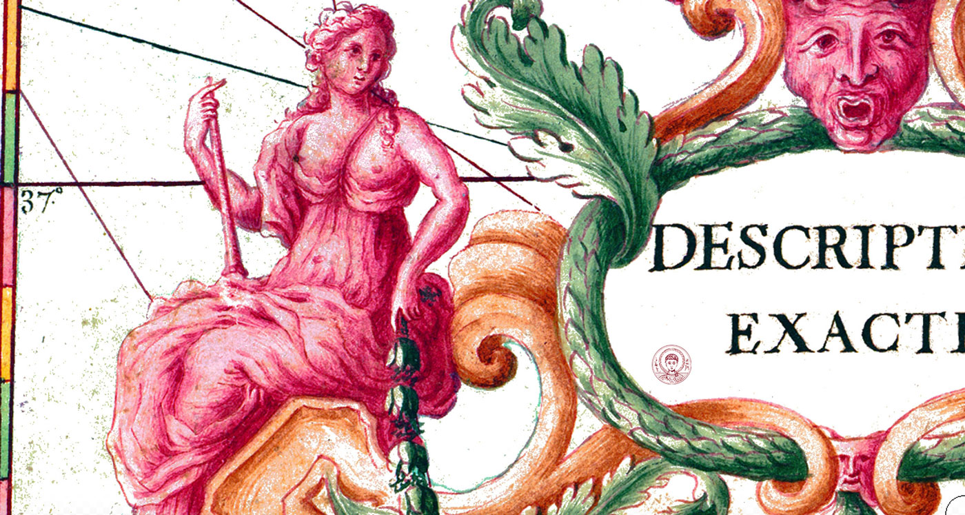
The influence of French classicism in 17th century cartography. Detail of the original Cartouche of Raseau map collection. Tricoglios Library LIC, AUTH.
Detailed illustration of the narrow sea between Paros and Antiparos with noted depths. Raseau Collection, Tricoglios Library LIC, AUTH.


